Map the Lawn You Actually Use Before Converting the Rest to Native Plants
Last updated: November 7, 2026
Most lawn conversion advice starts with which plants to buy. A better starting point is the lawn you would keep. If you know exactly which grass gets walked on, played on and mowed for a reason, everything else becomes a candidate for native plants.
The University of Maryland Extension puts it plainly: lawns are usually wanted for children’s play, pet runs, sports and framing an entry, yet in many yards they go largely unused. Plant NOVA Natives asks the same question: why not keep lawn only where you actually need it?
This guide walks through a simple mapping exercise. Over a couple of weeks you record how the yard is really used. You then sort the lawn into areas to keep, to convert and to leave for later, and match the converted areas to native plants that suit each one.
Plan at a Glance
| Site | Any yard with more lawn than you use |
| Size | Whole property; the map covers front, side and back |
| Sun | Mapped as part of the exercise; it decides the plant palette |
| Soil | Note wet spots, dry slopes and compacted strips as you map |
| Maintenance | Two weeks of observation, then one planning session |
| Best regions | Anywhere; the plant palette below is for eastern North America |
Step 1: Draw a Simple Base Map
Sketch the property to rough scale on graph paper, or print an aerial image and trace over it. Add the house, driveway, walks, fences, trees and large shrubs. Mark doors and gates, because nearly every traffic line starts or ends at one.
Measure the main lawn areas with a long tape and write the dimensions on the map. You will use them later to work out how much lawn you are keeping and how many square feet each new bed will need.
Add the things you cannot plant over or would rather not dig near: the septic field, utility boxes, the spigot and hose route, and air-conditioning units. Before you dig any new bed, contact 811 a few business days ahead so buried utilities can be marked on the ground.
Step 2: Track How You Use the Lawn for Two Weeks
Carry the map and a pencil for two weeks, ideally in the season when the yard sees the most use. Draw what actually happens rather than what you think happens.
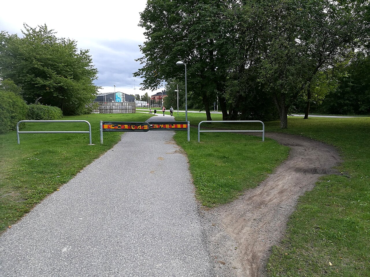
Traffic lines. Draw every route people take: door to car, gate to garden, kids to the neighbor’s yard. Worn or compacted strips in the grass are the clearest evidence.
These lines should stay walkable, as lawn, a mown path or a hard path.
Play and pet zones. Circle where children kick a ball and where the dog runs. The Northern Virginia master gardeners suggest keeping durable grass for play areas and heavily traveled footpaths.
Gathering and service areas. Mark where chairs go, where trash cans roll, and where you need room to reach a window, a meter or a downspout.
Snow and sightlines. Plant NOVA Natives suggests thinking about where snow and ice will be piled in winter, and whether road salt will reach the planting.
It also points out that low lawn lets you see across the yard, which can matter for security. Mark both on the map.
Step 3: Map Sun, Water, and Problem Spots
While you are observing, note the site conditions that will decide the plants. Record roughly how many hours of direct sun each part of the lawn gets, and check again in a different season if you can.
Look for the places where lawn already struggles. Both the Maryland Extension and Plant NOVA Natives point to steep slopes, heavy shade and spots that are hard or dangerous to mow as the first places to reconsider. Plant NOVA also mentions spots right next to walls and other vertical surfaces.
Mark wet spots after a heavy rain and dry, baked areas after a dry week. These become the separate planting zones described below. For wetter ground, our guide to native plants for a seasonally wet yard goes into more detail.
Note every tree’s drip line. Plant NOVA Natives says tree experts recommend removing grass out to the drip line, because lawn soil is compacted and mowers and string trimmers damage bark. For planting under trees, see our plan for a dry-shade native border.
Step 4: Sort the Lawn Into Keep, Convert, and Later
Lay tracing paper over the map and color three zones.
- Keep (green): Play areas, pet runs, main traffic lines and the open space that frames the house. Shape the kept lawn in simple, connected areas that are easy to mow.
- Convert (yellow): Lawn you rarely walk on, plus the problem spots from Step 3: slopes, deep shade, wet hollows, strips along fences and around trees.
- Later (blue): Areas you might convert once your needs change, such as a play lawn the kids will outgrow.
Rank the yellow areas. Start with the patch that is smallest, most visible and easiest to prepare. A first module of about 100 square feet is a sensible test; our phased plan for your first 100 square feet covers that step.
Plant NOVA Natives suggests expanding existing borders by a ribbon 2 to 4 feet wide each year. That is often the easiest way to shrink a yellow zone without facing a large area of bare soil all at once.
Step 5: Shape the Lawn You Keep
Once the keeper lawn is mapped, shape it on purpose. Plant NOVA Natives notes that curved borders reduce mowing time, so trace smooth, mower-friendly edges rather than tight corners.
Keep the kept areas connected by lawn or path so the mower can travel without crossing beds. Where a traffic line runs through a converted zone, leave a deliberate path along it. A path that follows the existing desire line is the one people will actually use.
Keep a clear edge between lawn and beds. A crisp mown or spade-cut edge shows the planting is intentional and slows lawn grass from creeping in.
Plant Palette for Converted Zones
Plant Palette by Zone
Heights and ranges are from the Lady Bird Johnson Wildflower Center, with moisture notes from NC State Extension; check each species against your county’s native list.
| Plant | Role | Height | Sun / Moisture | Native range |
|---|---|---|---|---|
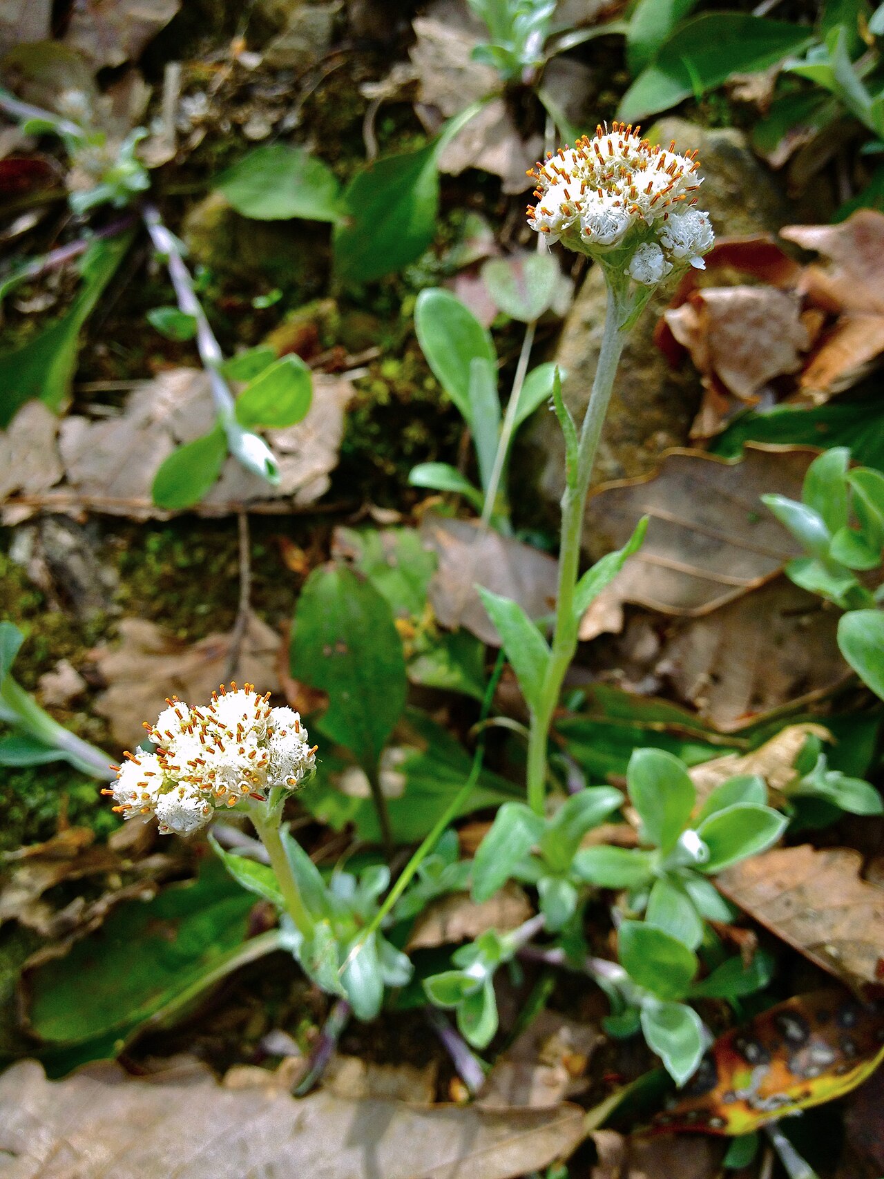
| Pussytoes | Low edge beside kept lawn or walks | Up to 10 in in bloom | Sun to part shade / dry | Quebec and ME south to FL, west to LA, north to MN |
| Wild strawberry | Groundcover for sunny edges | Up to about 4 in | Sun to part shade / dry | Newfoundland and e. Quebec to Manitoba, south to GA and OK |
| Purple lovegrass | Short grass for sunny strips | 8–18 in | Sun / medium, well-drained | ME to MN, south to FL and AZ |
| Blue-eyed grass | Spring accent in moist sun | Up to 18 in | Sun to part shade / moist | Newfoundland to Manitoba and WY, south to FL and TX |
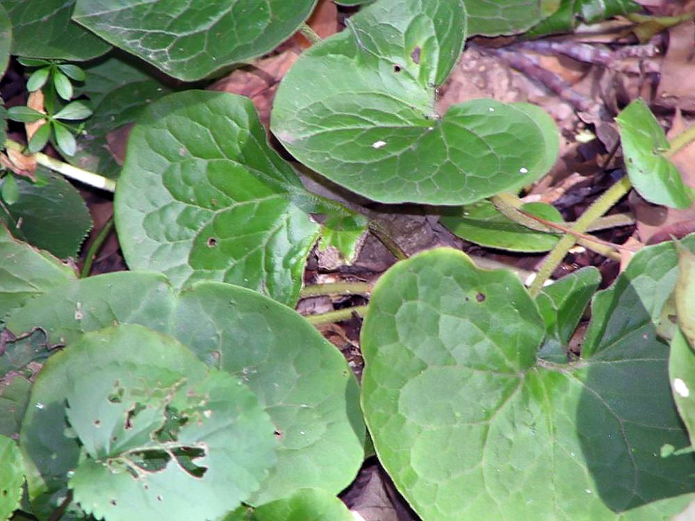
| Wild ginger | Groundcover under trees | Up to 8 in | Part shade to shade / moist | Quebec and NB to Ontario and MN, south to FL and LA |
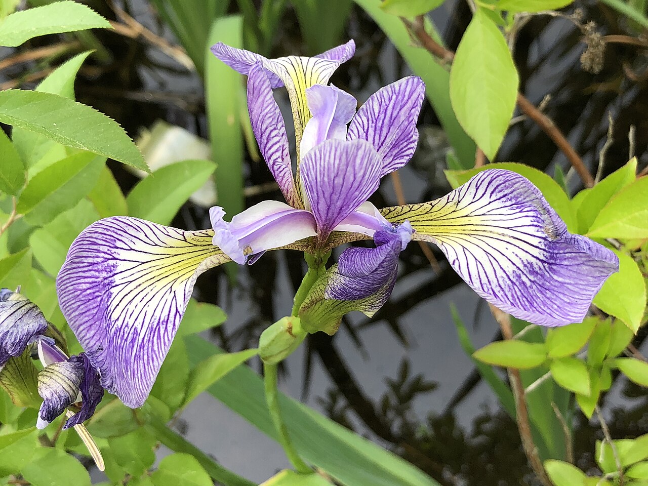
| Larger blue flag | Wet hollow, northern yards | Up to 3 ft | Sun to part shade / moist to wet | S. Labrador to Manitoba, south to w. VA, n. OH, MI and MN |
| Swamp milkweed | Wet hollow, monarch host | Up to 5 ft | Sun to part shade / moist to wet | Manitoba to Nova Scotia, south to GA, west to LA and TX, north to ND |
Regional alternates. Larger blue flag is a northern iris; in the Southeast, look for a locally native blue flag on your state list instead.
In the western Plains and Mountain West, low native grasses such as blue grama suit dry strips. In the Pacific states, use your state native plant society’s list for each zone.
Installation: Turn the Map Into a Work Plan
- Photograph the yard from the same spots you will compare against later.
- Outline the first yellow zone with a hose or flags and leave it for a week. If people keep walking through it, adjust the edge.
- Contact 811 before digging.
- Prepare the ground by removing or smothering the turf. Our comparison of sheet mulching and sod removal explains how to choose.
- Plant by zone, using the palette row that matches each area’s sun and moisture rather than one mix everywhere. Our plugs vs. seed comparison helps you decide how to plant each zone.
- Re-cut the lawn edge and add a path wherever the map showed a traffic line.
To fit each zone around a busy calendar, follow our two-season installation plan, which splits the work between fall and spring.
First-Three-Years Maintenance Calendar
- Year 1: Water new plants through their first summer. Weed the converted zone weekly, and re-cut the lawn edge monthly. Update the map wherever people still cut corners.
- Year 2: Weed every few weeks, cut back last year’s growth in late winter, and convert the next yellow zone.
- Year 3: Weed seasonally and review the blue zones. Lawn you kept “for later” may now be ready to convert.
Mistakes to Avoid
- Mapping from memory. You will forget the shortcut to the shed. Observe for two weeks.
- Planting across a traffic line. People will walk through the bed anyway. Give the route a path.
- One palette for every zone. A wet hollow, a dry slope and the shade under a maple need different plants.
- Leaving awkward lawn slivers. Narrow strips between beds are hard to mow. Either widen them or fold them into the bed.
- Converting everything at once. Phase the yellow zones so weeding stays manageable.
📋 Before you finalize a palette for each zone, check your regional native plant list, such as the Connecticut, Massachusetts and Rhode Island list or the Michigan, Wisconsin and eastern Minnesota list.
Frequently Asked Questions
How long should I observe my yard before converting lawn?
Two weeks in the busiest season is a good minimum. If you can, check again in a different season, because sun, wet spots and use patterns all shift through the year.
How much lawn should I keep?
Keep what you use for play, pets, gathering and moving around, and shape it so it is easy to mow. There is no fixed percentage; the map decides.
Where should I start converting?
Start with problem spots such as slopes, deep shade, wet hollows and strips that are awkward to mow. Then add the most visible unused area, in a small first module.
What about homeowners association rules?
Check your covenants first. Rules vary by state; the Maryland Extension notes, for example, that Maryland’s Low-Impact Landscaping Law prevents HOAs from requiring turf-only landscapes.
Do I need a professional landscape plan?
Not for most yards. A hand-drawn map, two weeks of observation and a tape measure answer the main questions. For broader options, see our guide to lawn reduction strategies for homeowners.
Sources
- University of Maryland Extension: Lawn Alternatives
- Plant NOVA Natives: Reducing Lawn
- Master Gardeners of Northern Virginia: Shrink the Lawn
- 811: Before You Dig
- Lady Bird Johnson Wildflower Center: Plant Database (ANPL, FRVI, ERSP, SIAN3, ASCA, IRVE2, ASIN)
- NC State Extension Plant Toolbox: Antennaria plantaginifolia