A Texas Native Planting Plan Starts With Your Ecoregion, Not Just Your ZIP Code
Last updated: November 7, 2026
Type your ZIP code into the USDA hardiness zone map and you’ll get a number such as 8b or 9a. It’s useful, but it tells you only how cold your winters get. It says nothing about whether your yard sits on black clay, sand or a thin layer of soil over limestone.
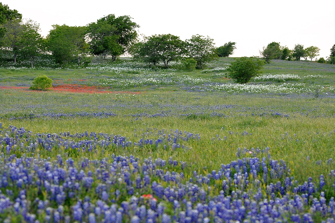
Texas has ten ecoregions, from east Texas pine forests to Trans-Pecos desert, and they differ more in rainfall and soil than in winter cold. Two homes with the same hardiness zone can need entirely different native plants.
This plan starts with your ecoregion, then reads your soil, and only then picks plants. The examples below are Texas natives matched to the regions where they grow naturally, with notes on where they don’t fit.
Plan at a Glance
| Site | Any Texas yard; works for a single bed or a whole-yard plan |
| Garden size | Any |
| Sun | Matched to the plant group; shade palettes included for east and central Texas |
| Soil | Determined by your ecoregion: acidic sand, alkaline clay, thin limestone or desert soils |
| Maintenance | Low once plants suit the region; more water only during establishment |
| Best regions | All ten Texas ecoregions; plant lists differ for each |
Why Your ZIP Code Isn’t Enough
The USDA describes its hardiness zone map as based on the average annual extreme minimum winter temperature, shown in 10-degree zones and 5-degree half zones. It’s the standard for judging which perennials will survive winter, and you can look up your zone by ZIP code.
Winter cold is just one limit in Texas. Texas Parks and Wildlife Department (TPWD) notes that annual rainfall ranges from about 8 inches in the far west Texas deserts to 56 inches in east Texas swamps. Soils range from acidic sands to alkaline clays and shallow soils over limestone.
A plant can be hardy in your zone and still fail because the soil is the wrong pH, the drainage is wrong or the rain never comes. That’s why many Texas native plant references group plants by ecoregion instead of zone.
Step 1: Find Your Ecoregion
TPWD divides Texas into ten ecoregions: Piney Woods, Gulf Prairies and Marshes, Post Oak Savannah, Blackland Prairies, Cross Timbers, South Texas Plains, Edwards Plateau, Rolling Plains, High Plains and Trans-Pecos. Find your location on TPWD’s ecoregion map before you shop.
Expect to land near a boundary. The Texas Master Naturalist Alamo Area Chapter notes that Bexar County alone takes in parts of four ecoregions (Edwards Plateau, Blackland Prairie, Post Oak Savannah and South Texas Plains). It also points out that ecoregion borders are gradual transitions rather than hard lines, and that smaller pockets inside a region can differ a lot from the overall description.
So a San Antonio ZIP code could put you on Hill Country limestone, on Blackland clay, or somewhere in between. Look at your actual soil and at what grows wild nearby.
Texas Ecoregions at a Glance
Rainfall and soils as described by Texas Parks and Wildlife Department.
| Ecoregion | Annual Rainfall | Typical Soils |
|---|---|---|
| Piney Woods | 36–50 in | Acidic gray sands and sandy loams |
| Gulf Prairies and Marshes | 30–50 in | Acidic sands and sandy loams; clays in river bottoms |
| Post Oak Savannah | 28–40 in | Acidic sandy loams and sands on uplands |
| Blackland Prairies | 28–40 in | Dark alkaline clays (“black gumbo”) with some acidic sandy loams |
| Cross Timbers | Moderate, erratic | Mostly sandy to loamy |
| South Texas Plains | 20–32 in | Alkaline to slightly acidic clays and clay loams; caliche in places |
| Edwards Plateau | 15–34 in | Shallow soils over limestone |
| Rolling Plains | 20–28 in | Sands to tight clays; neutral to slightly alkaline |
| High Plains | 15–22 in | Clays in the north, sands in the south, over caliche |
| Trans-Pecos | Mostly under 12 in | Varied mountain outwash; generally alkaline |
Step 2: Read the Soil Before the Plant List
Soil is where ecoregions matter most in a garden. The Alamo Area Master Naturalists explain the rule of thumb simply: limestone bedrock means alkaline soils, while sandstone and shale mean acidic soils, and plants follow the soil.
East of the Blackland Prairie, most native woodland plants are adapted to acidic sand. On the Edwards Plateau and farther west, natives are adapted to alkaline, rocky, fast-draining ground. Trying to move plants across that line usually means fighting the soil every year.
If you’re unsure, a basic soil test from your county extension office will tell you pH and texture. Then match plants to the soil you have instead of amending it to suit plants from another region.
Step 3: Build a Palette From Your Region
The groups below are examples, not complete lists. Each plant’s native habitat comes from the Lady Bird Johnson Wildflower Center, which is based in Austin and tracks Texas plants closely.
East Texas: Piney Woods and Post Oak Savannah
American beautyberry is a natural fit here. The Wildflower Center lists its habitat as woods, moist thickets and bottomlands in the Piney Woods and Post Oak region, and it grows 3 to 6 feet tall and wide in part shade.
Inland sea oats is a 2- to 4-foot shade grass of slopes, thickets and stream banks with drooping, oat-like seedheads. The Wildflower Center warns it yellows in continuous full sun.
Yaupon holly grows in sandy pinelands and also on limestone uplands, so it bridges east and central Texas. It’s usually under 25 feet and grows in sun or shade.
Blackland Prairie
This is clay country. TPWD notes the Blackland soils once supported tallgrass prairie of big bluestem, little bluestem, Indiangrass and switchgrass, and most of it has since been plowed.
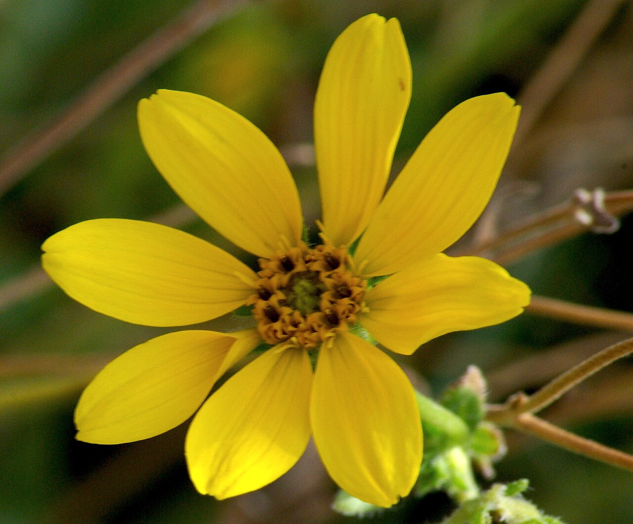
Engelmann daisy grows in open, calcareous fields and roadsides, reaching up to about 3 feet in sun and dry soil. Maximilian sunflower is a rich-prairie native with stems 3 to 10 feet tall, so give it a back-of-bed spot or a large yard.
Edwards Plateau (Hill Country)
TPWD describes the Edwards Plateau as stony hills and canyons with shallow soils over limestone. Its plants are built for that.
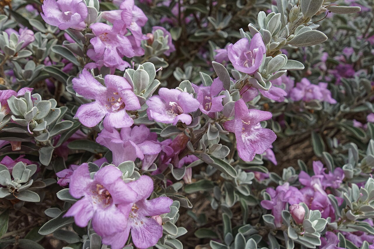
Lindheimer’s muhly is native from the Edwards Plateau south into northern Mexico, on limestone uplands near streams. It normally grows 2 to 5 feet tall, with blue-gray leaves, in sun.
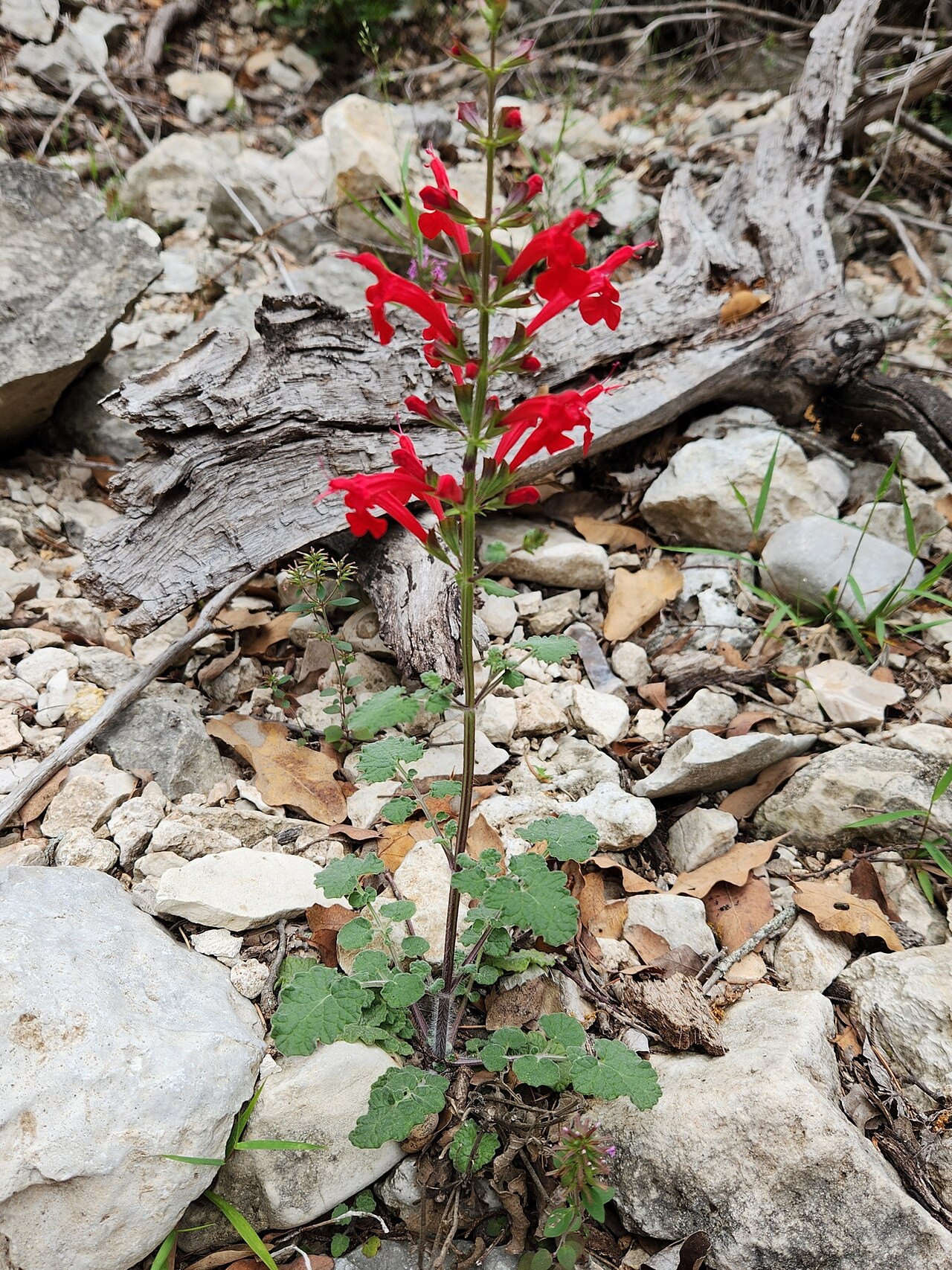
Cedar sage grows 1 to 2 feet tall in the shade of cedar brakes and oak woods on rocky limestone. The Wildflower Center notes that in Texas it’s found mainly on the Edwards Plateau, which makes it a red-flowered choice for dry part shade.
Agarita is an evergreen shrub usually 3 to 6 feet tall, with spiny, holly-like leaflets, fragrant yellow flowers in late winter and red berries. It grows on rocky slopes and open woods from coastal South Texas to the Trans-Pecos.
South Texas, the Gulf Coast and Central Texas Shade
Turk’s cap grows from central Texas east to Florida along streams, at wood edges and on wooded limestone slopes. It reaches up to 10 feet but is often shorter, and it handles part shade to shade.
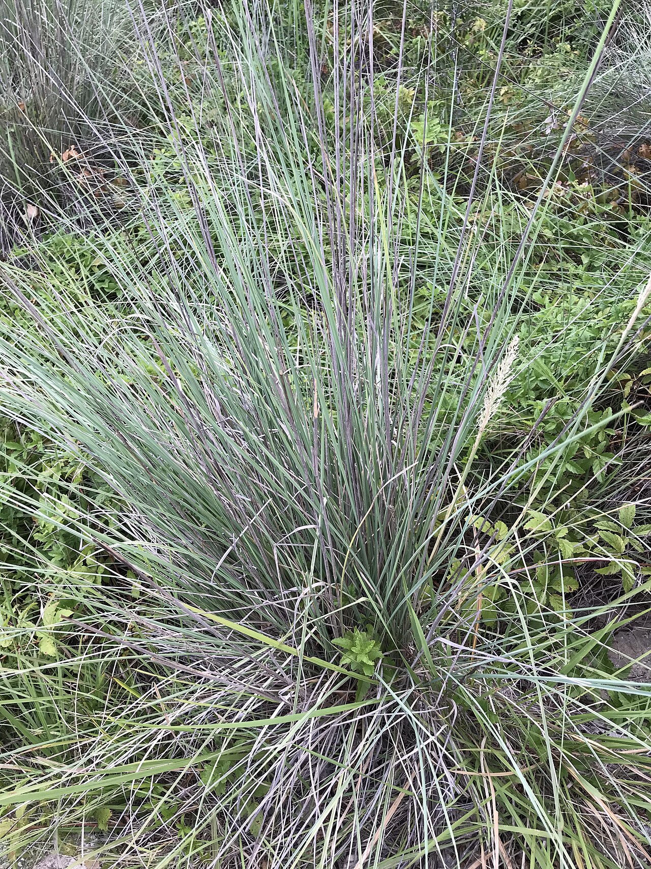
Cenizo is native in Texas to the Rio Grande Plain, the southern Trans-Pecos and the Edwards Plateau. It’s usually a 2- to 5-foot silvery shrub with pink-lavender flowers. The Wildflower Center notes it needs good drainage and is susceptible to cotton root rot.
West Texas: Trans-Pecos and High Plains Edges
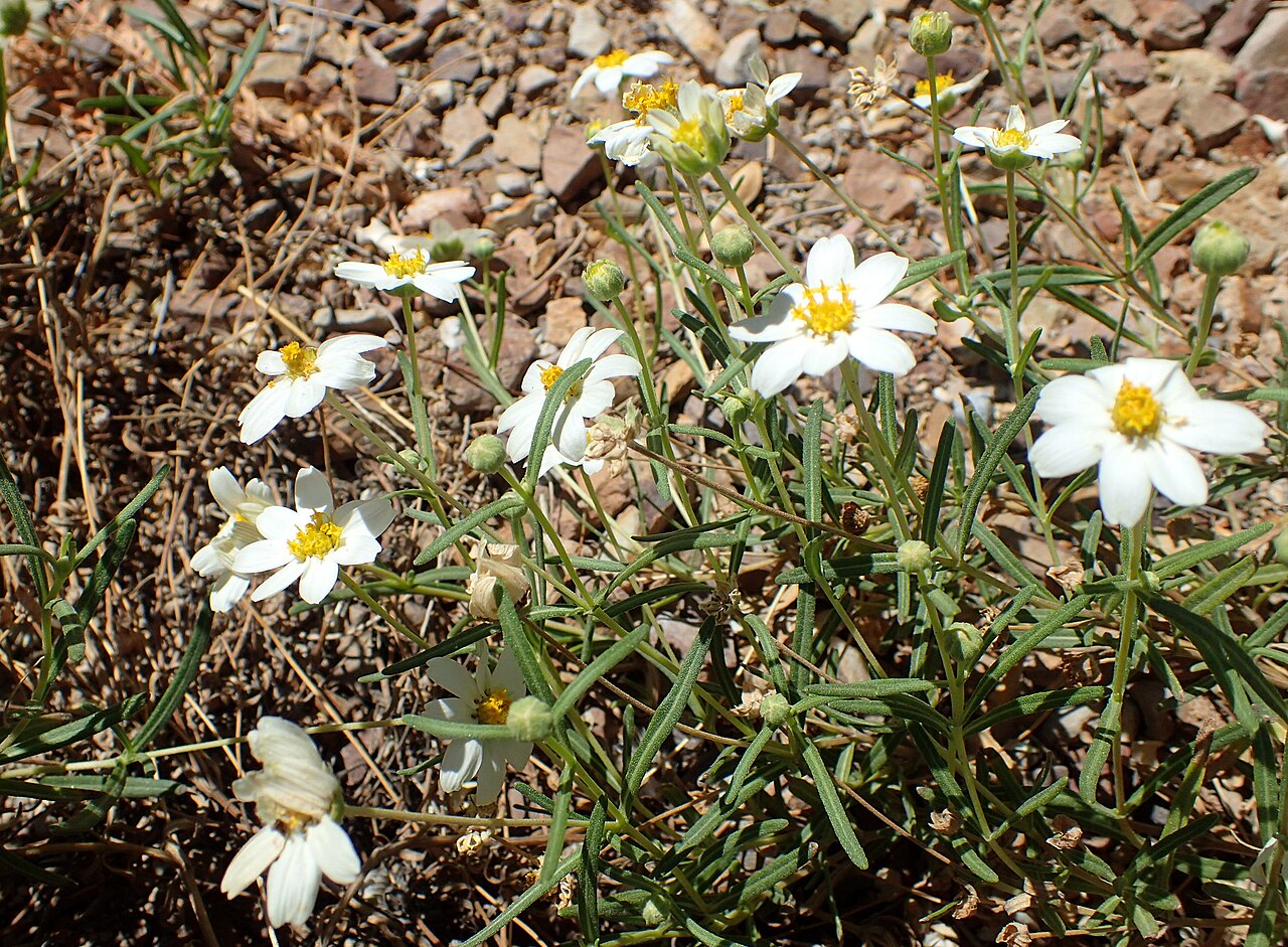
Blackfoot daisy is a low, mounding perennial, usually 6 to 12 inches tall and twice as wide, native from Colorado and Oklahoma south to Arizona, central Texas and Mexico on dry, calcareous soils. The Wildflower Center notes good drainage is essential.
Desert willow is another west Texas option for washes and arroyos, but it can reach 40 feet, so it belongs in a large yard.
Plant Palette by Ecoregion
Native habitat and range from the Lady Bird Johnson Wildflower Center.
| Plant | Best Ecoregion Fit | Height | Sun / Moisture | Native Range |
|---|---|---|---|---|
| American beautyberry | Piney Woods, Post Oak Savannah | 3–6 ft | Part shade / moist | VA to AR, south to FL and e. TX |
| Inland sea oats | East and central Texas shade | 2–4 ft | Part shade to shade / moist | PA to n. FL, west to e. KS and c. TX |
| Yaupon holly | East Texas; also limestone uplands | Usually under 25 ft | Sun to shade / dry to moist | S.e. VA to FL, west to AR, s.e. OK and s.c. TX |
| Engelmann daisy | Blackland Prairie and other calcareous sites | To about 3 ft | Sun / dry | KS, AR and CO south to TX, NM and n.e. Mexico |
| Maximilian sunflower | Blackland Prairie | 3–10 ft | Sun / dry to moist | MN to Sask., south to MO, OK and TX |
| Lindheimer’s muhly | Edwards Plateau | 2–5 ft | Sun / dry to moist | Edwards Plateau south to n. Mexico |
| Cedar sage | Edwards Plateau shade | 1–2 ft | Part shade / dry | Central and west TX to n. Mexico |
| Agarita | Edwards Plateau, South Texas, Trans-Pecos | 3–6 ft, up to 10 | Sun to part shade / dry to moist | Coastal s. TX through Trans-Pecos to s. AZ |
| Turk’s cap | Central and east Texas shade | Up to 10 ft, often shorter | Part shade to shade / dry to moist | Central TX east to FL, north to AR and SC |
| Cenizo | South Texas Plains, Edwards Plateau, s. Trans-Pecos | 2–5 ft, up to 10 | Sun to part shade / dry | Rio Grande Plain, s. Trans-Pecos, Edwards Plateau |
| Blackfoot daisy | Trans-Pecos, Edwards Plateau, dry calcareous sites | 6–12 in | Sun to part shade / dry | CO to OK, south to AZ, c. TX and Mexico |
Plan for Microsites Within Your Region
Even inside one ecoregion, your yard can have several conditions. The Alamo Area Master Naturalists note that thin, alkaline soil covers Edwards Plateau hills and slopes, while deeper soils lie along rivers and creeks. TPWD describes Blackland clays interspersed with sandy loams.
Map your own lot before planting. A low spot that holds water after storms, a rocky slope, a strip of deep fill soil along the foundation and the shade under a live oak all count as separate planting zones.
- Rocky, sunny, fast-draining spots: blackfoot daisy, cenizo and Lindheimer’s muhly.
- Dry shade under trees: cedar sage on alkaline soils, inland sea oats or Turk’s cap where there’s more moisture.
- Deep clay in full sun: Engelmann daisy and Maximilian sunflower.
If you irrigate, give each of these microsites its own watering schedule. Our California shrub border plan shows how grouping plants by water need works in practice.
How to Install a Region-Matched Bed
- Confirm your ecoregion and soil. Use TPWD’s map, then check soil texture and pH on the actual bed.
- Choose plants that fit the soil as it is. Skip heavy amendments meant to make soil suit plants from another region.
- Fix drainage where needed. Plants such as blackfoot daisy and cenizo need it; raise beds or plant on slopes in heavy clay.
- Buy from regional growers. Local nurseries and native plant society sales can usually tell you where their stock came from.
- Plant when temperatures are mild so roots can grow before the stress of summer heat, and water deeply until plants are established.
The First Three Years
Maintenance Calendar
- Year 1: Water deeply whenever the soil dries out, especially through the first summer. Pull weeds before they set seed.
- Year 1, winter: Leave seedheads and grass clumps standing for wildlife unless they’re blocking paths.
- Year 2: Begin stretching the time between waterings. Plants matched to your region should need less help each month.
- Year 2–3: Cut back blackfoot daisy by about half in late winter if it gets leggy, as the Wildflower Center suggests. Fill gaps with more of the same species.
- Year 3 and beyond: Water only during long droughts. Replace any plant that keeps struggling with one better suited to that microsite.
Mistakes to Avoid
- Treating “Texas native” as one category. A plant native to the Piney Woods may struggle on Hill Country limestone, and the reverse.
- Using the hardiness zone as the only filter. It measures winter cold, not rainfall or soil.
- Amending soil to grow plants from another region. It’s a constant battle; choose plants for your soil instead.
- Overwatering western natives. Plants like blackfoot daisy and cenizo need drainage more than water.
- Ignoring boundaries. If you live near the edge of two ecoregions, look at your own soil and nearby wild plants to decide which one your yard follows.
📋 For more plants, see the native plant list for South and West Texas or, in east Texas, the list for Arkansas, Louisiana, eastern Oklahoma and eastern Texas. For a statewide overview of popular choices, see the best Texas native plants for landscaping.
Frequently Asked Questions
How do I find my Texas ecoregion?
Use Texas Parks and Wildlife Department’s ecoregion map and find your county. If you’re near a boundary, check your soil and the wild plants nearby to decide which region your yard resembles.
Is my USDA hardiness zone still useful?
Yes, for winter survival. The USDA bases zones on average annual extreme minimum temperatures, so use the zone to rule out plants that can’t handle your coldest nights, then use your ecoregion for soil and rainfall.
Can I grow east Texas plants in the Hill Country?
Some, like yaupon holly, grow on both sandy and limestone soils. Many acid-soil woodland plants struggle on thin, alkaline Hill Country soil, so check each plant’s native habitat first.
What if my city sits in two ecoregions?
Many do. The Alamo Area Master Naturalists note that Bexar County alone includes parts of four ecoregions. Go by the soil in your own yard, not the city’s average.
Do native plants still need water?
Yes, while they establish. Water deeply through the first summer, then taper off as roots grow. Plants matched to your ecoregion should need little extra water after that.
Sources
- Texas Parks and Wildlife Department: Texas Ecoregions
- Texas Master Naturalist, Alamo Area Chapter: Ecoregions of South-Central Texas
- USDA Agricultural Research Service: Plant Hardiness Zone Map
- Lady Bird Johnson Wildflower Center: Callicarpa americana
- Lady Bird Johnson Wildflower Center: Muhlenbergia lindheimeri
- Lady Bird Johnson Wildflower Center: Salvia roemeriana
- Lady Bird Johnson Wildflower Center: Leucophyllum frutescens
- Lady Bird Johnson Wildflower Center: Melampodium leucanthum
- Lady Bird Johnson Wildflower Center: Engelmannia peristenia